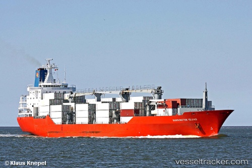
 Barrington Island
Current Status
Where is the vessel?
Barrington Island is currently in 154 nm S of Los Cabos, based on AIS data received about 17h ago.
Latest AIS update:
Current position: 20.44808° N, 110.82833° W (154 nm S of Los Cabos)
Average speed (last 7 days): Loading…
Average speed (last 30 days): Loading…
Vessel profile: Barrington Island is a Refrigerated Cargo Ship with dimensions 180m x 25m.
This page combines live AIS, route history, probable destination signals, nearby traffic, and port activity for practical vessel monitoring.
The current position of vessel Barrington Island is 20.44808 lat / -110.82833 lng. Updated: 2026-05-20 17:27:35 UTCNearest reference points:
- 67 nm S of Los Cabos
- 99 nm SE of Shitan
- 69 nm W of Los Cabos
Currently sailing under the flag of Bahamas ![]()
Barrington Island built in 1993 year
Deadweight:
14140 tDetails:
Live Vessel Barrington Island Analytics (details, animations, etc.)
Recent AIS points (UTC):
2026-05-20 13:38:27 UTC · 20.98907, -111.71589 · SOG 13.2 kn · COG 125°2026-05-20 16:08:11 UTC · 20.68676, -111.21756 · SOG 17.9 kn · COG 124°
2026-05-20 16:13:41 UTC · 20.67121, -111.19281 · SOG 18.8 kn · COG 122°
2026-05-20 17:27:35 UTC · 20.44808, -110.82833 · SOG 19.7 kn · COG 123°