 vesseltracker.com
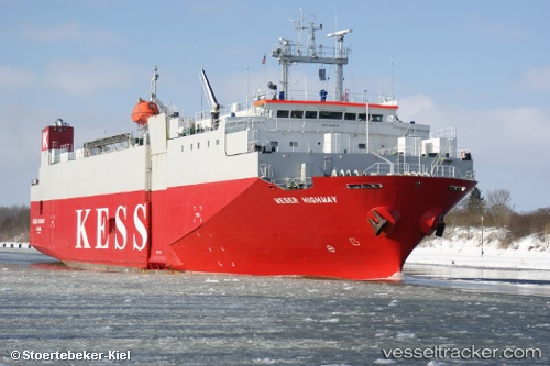
 Weser Highway
Current Status
Where is the vessel?
Weser Highway is currently in 19 nm N of Christiansø Havn, based on AIS data received less than 1h ago.
Latest AIS update:
Current position: 55.63320° N, 15.20312° E (19 nm N of Christiansø Havn)
Average speed (last 7 days): Loading…
Average speed (last 30 days): Loading…
Vessel profile: Weser Highway is a Vehicles Carrier with dimensions 100m x 20m.
This page combines live AIS, route history, probable destination signals, nearby traffic, and port activity for practical vessel monitoring.
The current position of vessel Weser Highway is 55.63320 lat / 15.20312 lng. Updated: 2026-04-24 16:16:15 UTCNearest reference points:
- Near RONNEBY
- Near TEJN
- Near Karlskrona
Currently sailing under the flag of Panama ![]()
Weser Highway built in 1994 year
Deadweight:
3222 tDetails:
Live Vessel Weser Highway Analytics (details, animations, etc.)
Recent AIS points (UTC):
2026-04-24 13:41:22 UTC · 55.95733, 16.15278 · SOG 14.4 kn · COG 239°2026-04-24 14:03:50 UTC · 55.91140, 16.01424 · SOG 14.4 kn · COG 237°
2026-04-24 16:10:21 UTC · 55.64537, 15.23962 · SOG 14.6 kn · COG 239°
2026-04-24 16:16:15 UTC · 55.63320, 15.20312 · SOG 14.9 kn · COG 238°