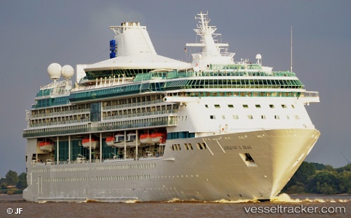
 Marella Discovery 2
Current Status
Where is the vessel?
Marella Discovery 2 is currently in 24 nm S of Giglio Porto, based on AIS data received about 15h ago.
Latest AIS update:
Current position: 41.96816° N, 11.08990° E (24 nm S of Giglio Porto)
Average speed (last 7 days): Loading…
Average speed (last 30 days): Loading…
Vessel profile: Marella Discovery 2 is a Cruise Ship with dimensions 264m x 36m.
This page combines live AIS, route history, probable destination signals, nearby traffic, and port activity for practical vessel monitoring.
The current position of vessel Marella Discovery 2 is 41.96816 lat / 11.08990 lng. Updated: 2026-06-13 02:03:39 UTCNearest reference points:
- Near Giglio Porto
- Near GIGLIO PORTO
- Near Tarquinia
Currently sailing under the flag of Bahamas ![]()
Marella Discovery 2 built in 1995 year
Deadweight:
5200 tDetails:
Live Vessel Marella Discovery 2 Analytics (details, animations, etc.)
Recent AIS points (UTC):
2026-06-12 22:23:50 UTC · 42.56066, 10.60083 · SOG 15.4 kn · COG 191°2026-06-13 00:01:39 UTC · 42.22446, 10.67946 · SOG 13.5 kn · COG 155°
2026-06-13 01:56:50 UTC · 41.97416, 11.06015 · SOG 11.6 kn · COG 105°
2026-06-13 02:03:39 UTC · 41.96816, 11.08990 · SOG 12.1 kn · COG 105°