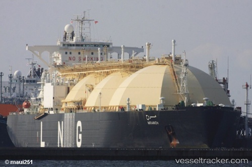
 Mraweh
Current Status
Where is the vessel?
Mraweh is currently in 164 nm SE of Miyakojima, based on AIS data received about 15h ago.
Latest AIS update:
Current position: 22.63667° N, 127.13833° E (164 nm SE of Miyakojima)
Average speed (last 7 days): Loading…
Average speed (last 30 days): Loading…
Vessel profile: Mraweh is a Lng Tanker with dimensions 290m x 290m.
This page combines live AIS, route history, probable destination signals, nearby traffic, and port activity for practical vessel monitoring.
The current position of vessel Mraweh is 22.63667 lat / 127.13833 lng. Updated: 2026-05-22 03:21:40 UTCNearest reference points:
- 77 nm SE of Miyakojima
Currently sailing under the flag of Liberia ![]()
Mraweh built in 1996 year
Deadweight:
73040 tDetails:
Live Vessel Mraweh Analytics (details, animations, etc.)
Recent AIS points (UTC):
2026-05-21 22:27:38 UTC · 23.20333, 128.28333 · SOG 15 kn · COG -1°2026-05-22 01:12:41 UTC · 22.87333, 127.63667 · SOG 15 kn · COG -1°
2026-05-22 01:12:41 UTC · 22.87333, 127.63667 · SOG 15 kn · COG -1°
2026-05-22 03:21:40 UTC · 22.63667, 127.13833 · SOG 15 kn · COG -1°