 vesseltracker.com
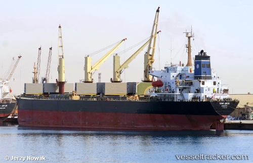
 Tatiana P
Current Status
Where is the vessel?
Tatiana P is currently in Near Port de Boké, based on AIS data received less than 1h ago.
Latest AIS update:
Current position: 10.41563° N, 14.82753° W (Near Port de Boké)
Average speed (last 7 days): Loading…
Average speed (last 30 days): Loading…
Vessel profile: Tatiana P is a Bulk Carrier with dimensions 186m x 30m.
This page combines live AIS, route history, probable destination signals, nearby traffic, and port activity for practical vessel monitoring.
The current position of vessel Tatiana P is 10.41563 lat / -14.82753 lng. Updated: 2026-05-01 22:09:03 UTCNearest reference points:
- Near Port de Boké
- 14 nm S of Port de Boké
- Near Dougoula
Currently sailing under the flag of Panama ![]()
Tatiana P built in 1995 year
Deadweight:
44809 tDetails:
Live Vessel Tatiana P Analytics (details, animations, etc.)
Recent AIS points (UTC):
2026-05-01 18:24:01 UTC · 10.41610, -14.82835 · SOG 0.1 kn · COG 193°2026-05-01 19:13:09 UTC · 10.41500, -14.82667 · SOG 0 kn · COG -1°
2026-05-01 19:55:11 UTC · 10.41500, -14.82667 · SOG 0 kn · COG -1°
2026-05-01 22:09:03 UTC · 10.41563, -14.82753 · SOG 0.2 kn · COG 211°