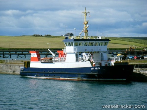
 Hoy Head
Current Status
Where is the vessel?
Hoy Head is currently in Near Houton, based on AIS data received about 14h ago.
Latest AIS update:
Current position: 58.91669° N, 3.18450° W (Near Houton)
Average speed (last 7 days): Loading…
Average speed (last 30 days): Loading…
Vessel profile: Hoy Head is a Passenger Ro Ro Cargo Ship with dimensions 50m x 10m.
This page combines live AIS, route history, probable destination signals, nearby traffic, and port activity for practical vessel monitoring.
The current position of vessel Hoy Head is 58.91669 lat / -3.18450 lng. Updated: 2026-06-04 10:25:01 UTCNearest reference points:
- Near STROMNESS
- Near Tingwall
- Near Staxigoe
Currently sailing under the flag of United Kingdom ![]()
Hoy Head built in 1994 year
Deadweight:
137 tDetails:
Live Vessel Hoy Head Analytics (details, animations, etc.)
Recent AIS points (UTC):
2026-06-04 07:32:50 UTC · 58.83771, -3.13140 · SOG 0 kn · COG 88°2026-06-04 08:12:02 UTC · 58.83348, -3.19108 · SOG 0 kn · COG 269°
2026-06-04 09:34:27 UTC · 58.83344, -3.19087 · SOG 0.7 kn · COG 279°
2026-06-04 10:25:01 UTC · 58.91669, -3.18450 · SOG 0 kn · COG 218°