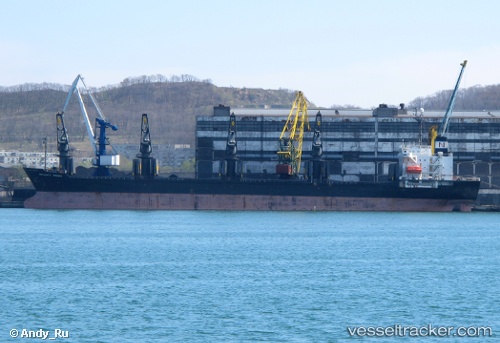
Tai Fu
Current StatusWhere is the vessel?
Tai Fu is currently in 20 nm SW of Kharg Island, based on AIS data received about 3d ago.
Latest AIS update:
Current position: 29.04500° N, 49.95333° E (20 nm SW of Kharg Island)
Average speed (last 7 days): Loading…
Average speed (last 30 days): Loading…
Vessel profile: Tai Fu is a Bulk Carrier with dimensions 24m x 156m.
This page combines live AIS, route history, probable destination signals, nearby traffic, and port activity for practical vessel monitoring.
The current position of vessel Tai Fu is 29.04500 lat / 49.95333 lng. Updated: 2026-05-16 14:11:07 UTCNearest reference points:
- 38 nm S of Soroosh (Cyrus) Terminal
- 41 nm S of Soroosh (Cyrus) Terminal
- 31 nm S of Soroosh (Cyrus) Terminal
Details:
Live Vessel Tai Fu Analytics (details, animations, etc.)
Recent AIS points (UTC):
2026-05-16 14:11:07 UTC · 29.04500, 49.95333 · SOG 9 kn · COG -1°2026-05-16 14:11:07 UTC · 29.04500, 49.95333 · SOG 9 kn · COG -1°
2026-05-16 14:11:07 UTC · 29.04500, 49.95333 · SOG 9 kn · COG -1°
2026-05-16 14:11:07 UTC · 29.04500, 49.95333 · SOG 9 kn · COG -1°