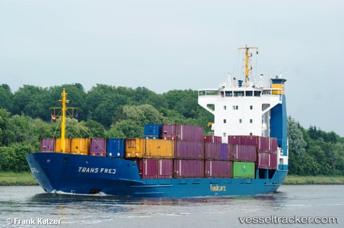
 Frej
Frej
Current Status
Where is the vessel?
Frej is currently in Near Hunsdon, based on AIS data received about 16h ago.
Latest AIS update:
Current position: 51.85440° N, 3.26192° E (Near Hunsdon)
Average speed (last 7 days): Loading…
Average speed (last 30 days): Loading…
Vessel profile: Frej is a Multi Purpose Carrier with dimensions 97m x 97m.
This page combines live AIS, route history, probable destination signals, nearby traffic, and port activity for practical vessel monitoring.
The current position of vessel Frej is 51.85440 lat / 3.26192 lng. Updated: 2026-05-20 19:04:15 UTCNearest reference points:
- Near Hunsdon
- 12 nm NE of Hunsdon
- Near Thorntonbank
Currently sailing under the flag of Antigua Barbuda ![]()
Frej built in 1994 year
Deadweight:
4470 tDetails:
Live Vessel Frej Analytics (details, animations, etc.)
Recent AIS points (UTC):
2026-05-20 16:25:24 UTC · 51.96336, 3.31308 · SOG 4.6 kn · COG 200°2026-05-20 16:25:57 UTC · 51.96264, 3.31284 · SOG 4.8 kn · COG 199°
2026-05-20 17:38:15 UTC · 51.87563, 3.27759 · SOG 2.1 kn · COG 208°
2026-05-20 19:04:15 UTC · 51.85440, 3.26192 · SOG 0.8 kn · COG 207°