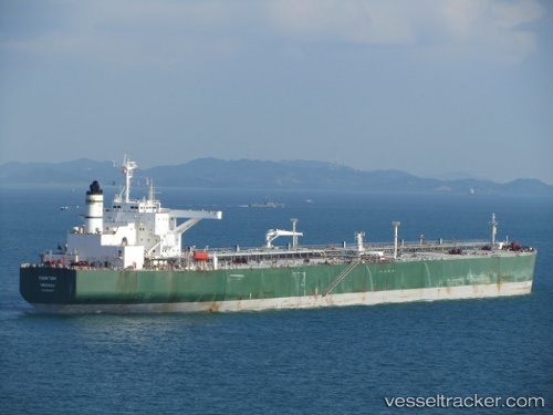
Hawtah
Current StatusWhere is the vessel?
Hawtah is currently in 17 nm SE of Bandar Al Mishab, based on AIS data received about 20h ago.
Latest AIS update:
Current position: 27.95375° N, 48.92509° E (17 nm SE of Bandar Al Mishab)
Average speed (last 7 days): Loading…
Average speed (last 30 days): Loading…
Vessel profile: Hawtah is a Crude Oil Tanker with dimensions 56m x 340m.
This page combines live AIS, route history, probable destination signals, nearby traffic, and port activity for practical vessel monitoring.
The current position of vessel Hawtah is 27.95375 lat / 48.92509 lng. Updated: 2026-05-20 06:59:42 UTCNearest reference points:
- Near Bandar Al Mishab
- 29 nm E of Bandar Al Mishab
- 26 nm E of Bandar Al Mishab
Details:
Live Vessel Hawtah Analytics (details, animations, etc.)
Recent AIS points (UTC):
2026-05-20 06:59:42 UTC · 27.95375, 48.92509 · SOG 13.5 kn · COG 231°2026-05-20 06:59:42 UTC · 27.95375, 48.92509 · SOG 13.5 kn · COG 231°
2026-05-20 06:59:42 UTC · 27.95375, 48.92509 · SOG 13.5 kn · COG 231°
2026-05-20 06:59:42 UTC · 27.95375, 48.92509 · SOG 13.5 kn · COG 231°