 GRACEFUL STAR
Current Status
Where is the vessel?
GRACEFUL STAR is currently in Near Yanbu Industrial City, based on AIS data received about 14h ago.
Latest AIS update:
Current position: 23.96178° N, 38.20422° E (Near Yanbu Industrial City)
Average speed (last 7 days): Loading…
Average speed (last 30 days): Loading…
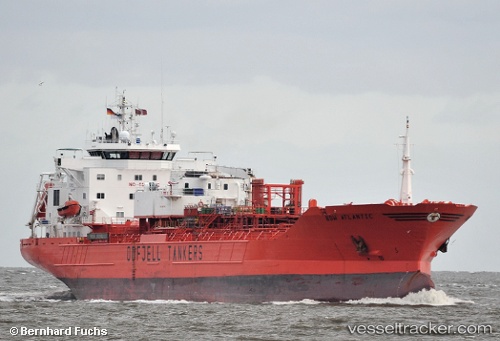
Vessel profile: GRACEFUL STAR is a Oil/Chemical Tanker with dimensions m x m.
This page combines live AIS, route history, probable destination signals, nearby traffic, and port activity for practical vessel monitoring.
The current position of vessel GRACEFUL STAR is 23.96178 lat / 38.20422 lng. Updated: 2026-05-20 01:47:08 UTCNearest reference points:
- 30 nm SW of Yanbu
- 42 nm NW of Fiji
- 35 nm S of Umm Lajj
Currently sailing under the flag of Panama ![]()
Details:
Live Vessel GRACEFUL STAR Analytics (details, animations, etc.)
Recent AIS points (UTC):
2026-05-19 22:30:47 UTC · 23.96180, 38.20424 · SOG 0 kn · COG 312°2026-05-19 23:43:01 UTC · 23.96167, 38.20500 · SOG 0 kn · COG -1°
2026-05-20 01:18:47 UTC · 23.96181, 38.20423 · SOG 0 kn · COG 312°
2026-05-20 01:47:08 UTC · 23.96178, 38.20422 · SOG 0 kn · COG 312°