 vesseltracker.com
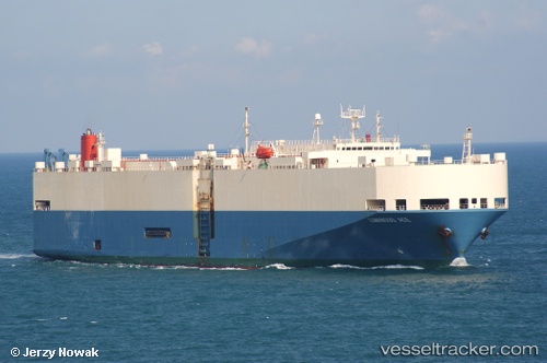
 Luminous Ace
Current Status
Where is the vessel?
Luminous Ace is currently in Near Fort Sherman, based on AIS data received about 976d ago.
Latest AIS update:
Current position: 9.36857° N, 79.95087° W (Near Fort Sherman)
Average speed (last 7 days): Loading…
Average speed (last 30 days): Loading…
Vessel profile: Luminous Ace is a Vehicles Carrier with dimensions 188m x 31m.
This page combines live AIS, route history, probable destination signals, nearby traffic, and port activity for practical vessel monitoring.
The current position of vessel Luminous Ace is 9.36857 lat / -79.95087 lng. Updated: 2023-09-15 19:56:05 UTCNearest reference points:
- Near Colon
- Near Colón Free Zone
- Near COLON 2000
Currently sailing under the flag of Panama ![]()
Luminous Ace built in 1995 year
Deadweight:
15181 tDetails:
Live Vessel Luminous Ace Analytics (details, animations, etc.)
Recent AIS points (UTC):
2023-09-15 19:56:05 UTC · 9.36857, -79.95087 · SOG 0 kn · COG -1°