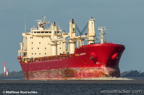
 ABRAHAM M
Current Status
Where is the vessel?
ABRAHAM M is currently in 12 nm NW of Chattogram, based on AIS data received about 325d ago.
Latest AIS update:
Current position: 22.49193° N, 91.70343° E (12 nm NW of Chattogram)
Average speed (last 7 days): Loading…
Average speed (last 30 days): Loading…
Vessel profile: ABRAHAM M is a Bulk Carrier with dimensions 200m x 23m.
This page combines live AIS, route history, probable destination signals, nearby traffic, and port activity for practical vessel monitoring.
The current position of vessel ABRAHAM M is 22.49193 lat / 91.70343 lng. Updated: 2025-07-01 08:50:16 UTCNearest reference points:
- 12 nm NW of Chattogram
- Near Chittagong
- 23 nm NW of Cox's Bazar
Currently sailing under the flag of Cook islands ![]()
ABRAHAM M built in 1996 year
Deadweight:
34167 tDetails:
Live Vessel ABRAHAM M Analytics (details, animations, etc.)
Recent AIS points (UTC):
2025-07-01 08:50:16 UTC · 22.49193, 91.70343 · SOG 0 kn · COG -1°