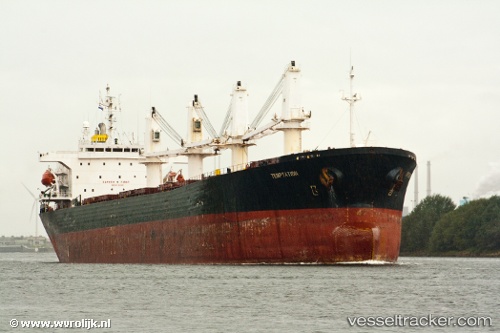
Best Future
Current StatusWhere is the vessel?
Best Future is currently in 13 nm N of Rozi, based on AIS data received about 14h ago.
Latest AIS update:
Current position: 22.77418° N, 70.10548° E (13 nm N of Rozi)
Average speed (last 7 days): Loading…
Average speed (last 30 days): Loading…
Vessel profile: Best Future is a Bulk Carrier with dimensions 30m x 189m.
This page combines live AIS, route history, probable destination signals, nearby traffic, and port activity for practical vessel monitoring.
The current position of vessel Best Future is 22.77418 lat / 70.10548 lng. Updated: 2026-05-21 02:08:50 UTCNearest reference points:
- 15 nm N of Rozi
- 12 nm N of Rozi
- Near Kandla
Details:
Live Vessel Best Future Analytics (details, animations, etc.)
Recent AIS points (UTC):
2026-05-20 21:38:50 UTC · 22.77551, 70.10882 · SOG 0.1 kn · COG 254°2026-05-20 22:08:50 UTC · 22.77553, 70.10877 · SOG 0.3 kn · COG 258°
2026-05-20 23:23:50 UTC · 22.77540, 70.10882 · SOG 0 kn · COG 254°
2026-05-21 02:08:50 UTC · 22.77418, 70.10548 · SOG 0 kn · COG 35°