 vesseltracker.com
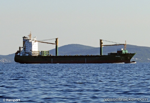
 Msc Claudia
Current Status
Where is the vessel?
Msc Claudia is currently in Near Casablanca, based on AIS data received less than 1h ago.
Latest AIS update:
Current position: 33.60603° N, 7.59686° W (Near Casablanca)
Average speed (last 7 days): Loading…
Average speed (last 30 days): Loading…
Vessel profile: Msc Claudia is a Container Ship with dimensions 159m x 24m.
This page combines live AIS, route history, probable destination signals, nearby traffic, and port activity for practical vessel monitoring.
The current position of vessel Msc Claudia is 33.60603 lat / -7.59686 lng. Updated: 2026-05-16 12:09:50 UTCNearest reference points:
- Near Mohammedia
- Near Jorf Lasfar
- 54 nm N of El Jadida
Currently sailing under the flag of Liberia ![]()
Msc Claudia built in 1996 year
Deadweight:
18335 tDetails:
Live Vessel Msc Claudia Analytics (details, animations, etc.)
Recent AIS points (UTC):
2026-05-16 07:47:35 UTC · 33.60603, -7.59685 · SOG 0 kn · COG 332°2026-05-16 10:05:15 UTC · 33.60603, -7.59687 · SOG 0 kn · COG 332°
2026-05-16 10:11:55 UTC · 33.60601, -7.59690 · SOG 0 kn · COG 332°
2026-05-16 12:09:50 UTC · 33.60603, -7.59686 · SOG 0 kn · COG 332°