 ALONDRA
Current Status
Where is the vessel?
ALONDRA is currently in 49 nm S of Araruama, based on AIS data received about 16h ago.
Latest AIS update:
Current position: 23.67544° S, 42.50767° W (49 nm S of Araruama)
Average speed (last 7 days): Loading…
Average speed (last 30 days): Loading…
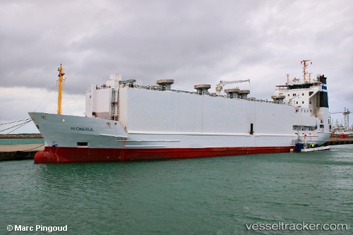
Vessel profile: ALONDRA is a Livestock Carrier with dimensions 97m x 16m.
This page combines live AIS, route history, probable destination signals, nearby traffic, and port activity for practical vessel monitoring.
The current position of vessel ALONDRA is -23.67544 lat / -42.50767 lng. Updated: 2026-05-21 01:47:11 UTCNearest reference points:
- Near Santos Dumont Apt/Rio de Janeiro
- 69 nm NE of Cidade de Angra dos Reis FPSO
- 27 nm SW of Santos Dumont Apt/Rio de Janeiro
Currently sailing under the flag of Denmark (DIS) ![]()
ALONDRA built in 1995 year
Deadweight:
2796 tDetails:
Live Vessel ALONDRA Analytics (details, animations, etc.)
Recent AIS points (UTC):
2026-05-20 22:19:44 UTC · -23.23167, -41.91000 · SOG 11 kn · COG -1°2026-05-20 23:54:10 UTC · -23.42345, -42.17271 · SOG 12.7 kn · COG 226°
2026-05-21 01:31:41 UTC · -23.63931, -42.46257 · SOG 12.8 kn · COG 223°
2026-05-21 01:47:11 UTC · -23.67544, -42.50767 · SOG 12.6 kn · COG 223°