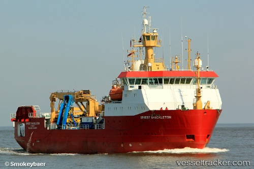
 LAURA BASSI
Current Status
Where is the vessel?
LAURA BASSI is currently in Near San Giusto, based on AIS data received about 14h ago.
Latest AIS update:
Current position: 45.63368° N, 13.77499° E (Near San Giusto)
Average speed (last 7 days): Loading…
Average speed (last 30 days): Loading…
Vessel profile: LAURA BASSI is a Research Vessel with dimensions 80m x 17m.
This page combines live AIS, route history, probable destination signals, nearby traffic, and port activity for practical vessel monitoring.
The current position of vessel LAURA BASSI is 45.63368 lat / 13.77499 lng. Updated: 2026-05-20 13:25:11 UTCNearest reference points:
- Near Trieste
- Near Ankaran
- Near IZOLA
Currently sailing under the flag of Italy ![]()
LAURA BASSI built in 1995 year
Deadweight:
2134 tDetails:
Live Vessel LAURA BASSI Analytics (details, animations, etc.)
Recent AIS points (UTC):
2026-05-20 09:37:22 UTC · 45.63368, 13.77498 · SOG 0 kn · COG 207°2026-05-20 10:25:23 UTC · 45.63369, 13.77498 · SOG 0 kn · COG 207°
2026-05-20 11:52:12 UTC · 45.63368, 13.77499 · SOG 0 kn · COG 207°
2026-05-20 13:25:11 UTC · 45.63368, 13.77499 · SOG 0 kn · COG 207°