 vesseltracker.com
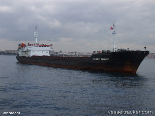
Mahmud Rehimov
Current StatusWhere is the vessel?
Mahmud Rehimov is currently in Near Krasnovodsk, based on AIS data received about 14h ago.
Latest AIS update:
Current position: 40.00245° N, 53.03076° E (Near Krasnovodsk)
Average speed (last 7 days): Loading…
Average speed (last 30 days): Loading…
Vessel profile: Mahmud Rehimov is a General Cargo Ship with dimensions 17m x 118m.
This page combines live AIS, route history, probable destination signals, nearby traffic, and port activity for practical vessel monitoring.
The current position of vessel Mahmud Rehimov is 40.00245 lat / 53.03076 lng. Updated: 2026-05-18 05:02:49 UTCNearest reference points:
- Near Krasnovodsk
- Near Hazar
- 42 nm W of Hazar
Details:
Live Vessel Mahmud Rehimov Analytics (details, animations, etc.)
Recent AIS points (UTC):
2026-05-17 23:44:48 UTC · 40.00247, 53.03076 · SOG 0 kn · COG 83°2026-05-18 01:53:49 UTC · 40.00242, 53.03074 · SOG 0 kn · COG 83°
2026-05-18 03:59:55 UTC · 40.00251, 53.03080 · SOG 0 kn · COG 82°
2026-05-18 05:02:49 UTC · 40.00245, 53.03076 · SOG 0 kn · COG 83°