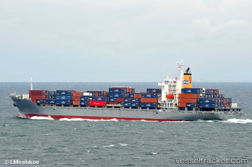
 Oriental Galaxy
Current Status
Where is the vessel?
Oriental Galaxy is currently in 61 nm SE of Panakukang, based on AIS data received about 18h ago.
Latest AIS update:
Current position: 5.74538° S, 120.24025° E (61 nm SE of Panakukang)
Average speed (last 7 days): Loading…
Average speed (last 30 days): Loading…
Vessel profile: Oriental Galaxy is a Container Ship with dimensions m x 183m.
This page combines live AIS, route history, probable destination signals, nearby traffic, and port activity for practical vessel monitoring.
The current position of vessel Oriental Galaxy is -5.74538 lat / 120.24025 lng. Updated: 2026-06-30 04:35:41 UTCNearest reference points:
- 83 nm SE of Panakukang
- Near Makassar
- Near Panakukang
Currently sailing under the flag of Indonesia ![]()
Oriental Galaxy built in 1996 year
Deadweight:
23650 tDetails:
Live Vessel Oriental Galaxy Analytics (details, animations, etc.)
Recent AIS points (UTC):
2026-06-30 04:35:41 UTC · -5.74538, 120.24025 · SOG 11 kn · COG -1°2026-06-30 04:35:41 UTC · -5.74538, 120.24025 · SOG 11 kn · COG -1°
2026-06-30 04:35:41 UTC · -5.74538, 120.24025 · SOG 11 kn · COG -1°
2026-06-30 04:35:41 UTC · -5.74538, 120.24025 · SOG 11 kn · COG -1°