 Chang Yahng
Current Status
Where is the vessel?
Chang Yahng is currently in Near Incheon, based on AIS data received about 14h ago.
Latest AIS update:
Current position: 37.43852° N, 126.61241° E (Near Incheon)
Average speed (last 7 days): Loading…
Average speed (last 30 days): Loading…
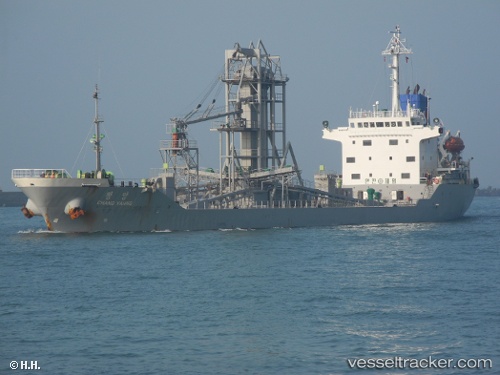
Vessel profile: Chang Yahng is a Cement Carrier with dimensions 122m x 19m.
This page combines live AIS, route history, probable destination signals, nearby traffic, and port activity for practical vessel monitoring.
The current position of vessel Chang Yahng is 37.43852 lat / 126.61241 lng. Updated: 2026-05-24 19:38:18 UTCNearest reference points:
- Near Incheon
- Near Gyeongin
- 14 nm SW of Incheon
Currently sailing under the flag of Korea ![]()
Chang Yahng built in 1996 year
Deadweight:
10562 tDetails:
Live Vessel Chang Yahng Analytics (details, animations, etc.)
Recent AIS points (UTC):
2026-05-24 16:15:45 UTC · 37.43849, 126.61243 · SOG 0 kn · COG 115°2026-05-24 17:51:45 UTC · 37.43848, 126.61240 · SOG 0 kn · COG 115°
2026-05-24 19:38:18 UTC · 37.43852, 126.61241 · SOG 0 kn · COG -1°
2026-05-24 19:38:18 UTC · 37.43852, 126.61241 · SOG 0 kn · COG -1°