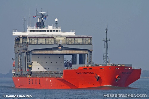
 SAGA HORIZON
Current Status
Where is the vessel?
SAGA HORIZON is currently in 108 nm W of Bear River City, based on AIS data received about 16h ago.
Latest AIS update:
Current position: 42.13117° N, 13.76786° W (108 nm W of Bear River City)
Average speed (last 7 days): Loading…
Average speed (last 30 days): Loading…
Vessel profile: SAGA HORIZON is a General Cargo with dimensions m x m.
This page combines live AIS, route history, probable destination signals, nearby traffic, and port activity for practical vessel monitoring.
The current position of vessel SAGA HORIZON is 42.13117 lat / -13.76786 lng. Updated: 2026-05-21 03:56:04 UTCNearest reference points:
- 25 nm S of Bear River City
- 43 nm NW of Utiel
Currently sailing under the flag of Bahamas ![]()
Details:
Live Vessel SAGA HORIZON Analytics (details, animations, etc.)
Recent AIS points (UTC):
2026-05-21 01:09:00 UTC · 42.40189, -13.22216 · SOG 10.6 kn · COG 238°2026-05-21 01:18:56 UTC · 42.38527, -13.25385 · SOG 10.5 kn · COG 237°
2026-05-21 03:02:23 UTC · 42.21562, -13.59361 · SOG 10.4 kn · COG 237°
2026-05-21 03:56:04 UTC · 42.13117, -13.76786 · SOG 10.6 kn · COG 237°