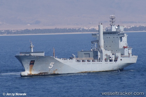
 Ka Bunga Mas 5
Current Status
Where is the vessel?
Ka Bunga Mas 5 is currently in 13 nm W of SUTERA, based on AIS data received about 14d ago.
Latest AIS update:
Current position: 6.03122° N, 115.84395° E (13 nm W of SUTERA)
Average speed (last 7 days): Loading…
Average speed (last 30 days): Loading…
Vessel profile: Ka Bunga Mas 5 is a Service Ship with dimensions 133m x 133m.
This page combines live AIS, route history, probable destination signals, nearby traffic, and port activity for practical vessel monitoring.
The current position of vessel Ka Bunga Mas 5 is 6.03122 lat / 115.84395 lng. Updated: 2026-05-07 11:41:10 UTCNearest reference points:
- Near Kota Kinabalu
- 44 nm SW of Tembungo
- Near Kikeh
Currently sailing under the flag of Malaysia ![]()
Ka Bunga Mas 5 built in 1997 year
Deadweight:
8991 tDetails:
Live Vessel Ka Bunga Mas 5 Analytics (details, animations, etc.)
Recent AIS points (UTC):
2026-05-07 11:41:10 UTC · 6.03122, 115.84395 · SOG 8.8 kn · COG 241°