 vesseltracker.com
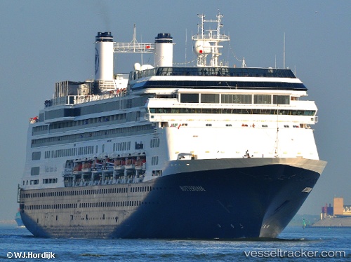
 BOREALIS
Current Status
Where is the vessel?
BOREALIS is currently in 17 nm NE of Lucciana, based on AIS data received less than 1h ago.
Latest AIS update:
Current position: 43.77138° N, 9.61903° E (17 nm NE of Lucciana)
Average speed (last 7 days): Loading…
Average speed (last 30 days): Loading…
Vessel profile: BOREALIS is a Passenger (Cruise) Ship with dimensions 32m x 239m.
This page combines live AIS, route history, probable destination signals, nearby traffic, and port activity for practical vessel monitoring.
The current position of vessel BOREALIS is 43.77138 lat / 9.61903 lng. Updated: 2026-05-16 01:49:59 UTCNearest reference points:
- 16 nm N of Lucciana
- 17 nm W of Marina di Pisa
- Near Vernazza
Currently sailing under the flag of Bahamas ![]()
BOREALIS built in 1997 year
Deadweight:
6351 tDetails:
Live Vessel BOREALIS Analytics (details, animations, etc.)
Recent AIS points (UTC):
2026-05-15 22:12:59 UTC · 43.53328, 9.95268 · SOG 9.2 kn · COG 276°2026-05-15 23:45:18 UTC · 43.55568, 9.62372 · SOG 9.5 kn · COG 268°
2026-05-16 01:25:38 UTC · 43.73391, 9.54306 · SOG 9.7 kn · COG 55°
2026-05-16 01:49:59 UTC · 43.77138, 9.61903 · SOG 9.9 kn · COG 52°