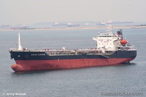
 FLY GURNARD
Current Status
Where is the vessel?
FLY GURNARD is currently in 55 nm NE of Kampung Tanjung Langsat, based on AIS data received about 14h ago.
Latest AIS update:
Current position: 2.11063° N, 104.68013° E (55 nm NE of Kampung Tanjung Langsat)
Average speed (last 7 days): Loading…
Average speed (last 30 days): Loading…
Vessel profile: FLY GURNARD is a Oil Products Tanker with dimensions m x m.
This page combines live AIS, route history, probable destination signals, nearby traffic, and port activity for practical vessel monitoring.
The current position of vessel FLY GURNARD is 2.11063 lat / 104.68013 lng. Updated: 2026-05-22 22:05:21 UTCNearest reference points:
- 53 nm NE of PENGERANG
- 52 nm NE of PENGERANG
- 64 nm NE of PENGERANG
Currently sailing under the flag of Sao Tome and Principe ![]()
Details:
Live Vessel FLY GURNARD Analytics (details, animations, etc.)
Recent AIS points (UTC):
2026-05-22 19:32:31 UTC · 2.11032, 104.68053 · SOG 0.1 kn · COG 227°2026-05-22 19:37:51 UTC · 2.11038, 104.68039 · SOG 0.1 kn · COG 220°
2026-05-22 21:22:52 UTC · 2.11064, 104.68003 · SOG 0.1 kn · COG 196°
2026-05-22 22:05:21 UTC · 2.11063, 104.68013 · SOG 0 kn · COG 197°