 Hjotirc
Current Status
Where is the vessel?
Hjotirc is currently in 30 nm NW of Hailuoto, based on AIS data received about 14h ago.
Latest AIS update:
Current position: 65.23989° N, 23.79095° E (30 nm NW of Hailuoto)
Average speed (last 7 days): Loading…
Average speed (last 30 days): Loading…
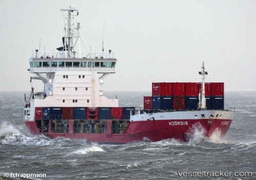
Vessel profile: Hjotirc is a Multi Purpose Carrier with dimensions 120m x 118m.
This page combines live AIS, route history, probable destination signals, nearby traffic, and port activity for practical vessel monitoring.
The current position of vessel Hjotirc is 65.23989 lat / 23.79095 lng. Updated: 2026-05-20 16:14:18 UTCNearest reference points:
- Near Karlsborg Axelvik
Currently sailing under the flag of Finland ![]()
Hjotirc built in 1996 year
Deadweight:
6410 tDetails:
Live Vessel Hjotirc Analytics (details, animations, etc.)
Recent AIS points (UTC):
2026-05-20 13:02:28 UTC · 65.74431, 24.15702 · SOG 6.3 kn · COG 167°2026-05-20 13:50:26 UTC · 65.62536, 24.38099 · SOG 14.6 kn · COG 127°
2026-05-20 15:56:28 UTC · 65.29173, 23.87462 · SOG 12.5 kn · COG 214°
2026-05-20 16:14:18 UTC · 65.23989, 23.79095 · SOG 12.7 kn · COG 216°