 LOLO GATE
Current Status
Where is the vessel?
LOLO GATE is currently in 18 nm NE of Qulaybiyah, based on AIS data received about 15h ago.
Latest AIS update:
Current position: 37.09207° N, 11.33638° E (18 nm NE of Qulaybiyah)
Average speed (last 7 days): Loading…
Average speed (last 30 days): Loading…
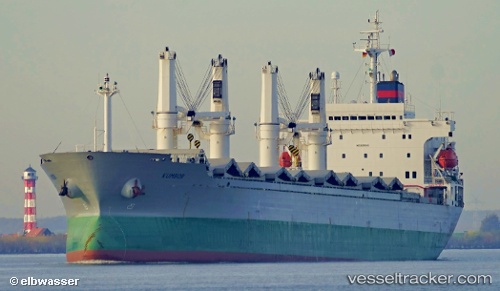
Vessel profile: LOLO GATE is a Bulk Carrier with dimensions m x m.
This page combines live AIS, route history, probable destination signals, nearby traffic, and port activity for practical vessel monitoring.
The current position of vessel LOLO GATE is 37.09207 lat / 11.33638 lng. Updated: 2026-05-20 19:01:44 UTCNearest reference points:
- 13 nm N of Qulaybiyah
- 32 nm N of Qulaybiyah
- Near Le Kram
Currently sailing under the flag of San Marino ![]()
Details:
Live Vessel LOLO GATE Analytics (details, animations, etc.)
Recent AIS points (UTC):
2026-05-20 16:22:05 UTC · 37.10510, 10.69974 · SOG 12.4 kn · COG 35°2026-05-20 16:27:05 UTC · 37.11941, 10.71224 · SOG 12.5 kn · COG 35°
2026-05-20 17:36:05 UTC · 37.15106, 10.96832 · SOG 12.5 kn · COG 101°
2026-05-20 19:01:44 UTC · 37.09207, 11.33638 · SOG 12.6 kn · COG 99°