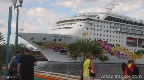
Norwegian Sky
Current StatusWhere is the vessel?
Norwegian Sky is currently in 20 nm SE of Krieschow, based on AIS data received about 14h ago.
Latest AIS update:
Current position: 51.51848° N, 2.21236° E (20 nm SE of Krieschow)
Average speed (last 7 days): Loading…
Average speed (last 30 days): Loading…
Vessel profile: Norwegian Sky is a Cruise Ship with dimensions 32m x 259m.
This page combines live AIS, route history, probable destination signals, nearby traffic, and port activity for practical vessel monitoring.
The current position of vessel Norwegian Sky is 51.51848 lat / 2.21236 lng. Updated: 2026-05-19 04:14:12 UTCNearest reference points:
- 13 nm NW of Middelkerke
- 15 nm E of RAMSGATE
- Near Dunkerque
Details:
Live Vessel Norwegian Sky Analytics (details, animations, etc.)
Recent AIS points (UTC):
2026-05-19 01:21:49 UTC · 50.79642, 1.36301 · SOG 21.1 kn · COG 15°2026-05-19 01:50:12 UTC · 50.95817, 1.44188 · SOG 21.9 kn · COG 25°
2026-05-19 04:00:24 UTC · 51.47134, 2.14590 · SOG 16.3 kn · COG 44°
2026-05-19 04:14:12 UTC · 51.51848, 2.21236 · SOG 16.4 kn · COG 44°