 vesseltracker.com
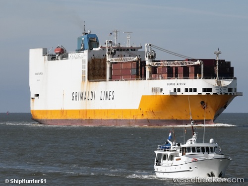
 GRANDE AFRICA
Current Status
Where is the vessel?
GRANDE AFRICA is currently in Near Freetown, based on AIS data received about 14h ago.
Latest AIS update:
Current position: 8.49425° N, 13.21530° W (Near Freetown)
Average speed (last 7 days): Loading…
Average speed (last 30 days): Loading…
Vessel profile: GRANDE AFRICA is a Ro-Ro Cargo Ship with dimensions 32m x 214m.
This page combines live AIS, route history, probable destination signals, nearby traffic, and port activity for practical vessel monitoring.
The current position of vessel GRANDE AFRICA is 8.49425 lat / -13.2153 lng. Updated: 2026-05-18 14:02:12 UTCNearest reference points:
- Near Kissy
- Near NASSIT
- 28 nm S of Conakry
Currently sailing under the flag of Malta ![]()
GRANDE AFRICA built in 1998 year
Deadweight:
27965 tDetails:
Live Vessel GRANDE AFRICA Analytics (details, animations, etc.)
Recent AIS points (UTC):
2026-05-18 10:08:56 UTC · 8.49426, -13.21530 · SOG 0 kn · COG 89°2026-05-18 11:20:56 UTC · 8.49425, -13.21530 · SOG 0 kn · COG 89°
2026-05-18 13:50:12 UTC · 8.49426, -13.21520 · SOG 0 kn · COG 88°
2026-05-18 14:02:12 UTC · 8.49425, -13.21530 · SOG 0 kn · COG 89°