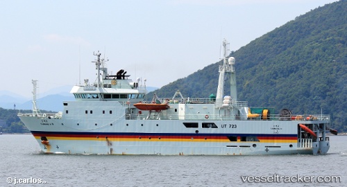
Tamhae2
Current StatusWhere is the vessel?
Tamhae2 is currently in Near TAEAN-GUN, based on AIS data received about 15h ago.
Latest AIS update:
Current position: 36.91636° N, 126.24304° E (Near TAEAN-GUN)
Average speed (last 7 days): Loading…
Average speed (last 30 days): Loading…
Vessel profile: Tamhae2 is a Research Vessel with dimensions 15m x 65m.
This page combines live AIS, route history, probable destination signals, nearby traffic, and port activity for practical vessel monitoring.
The current position of vessel Tamhae2 is 36.91636 lat / 126.24304 lng. Updated: 2026-05-20 19:00:08 UTCNearest reference points:
- Near DAESAN
- Near Taean-gun
- 10 nm N of DAESAN
Details:
Live Vessel Tamhae2 Analytics (details, animations, etc.)
Recent AIS points (UTC):
2026-05-20 15:50:29 UTC · 36.91500, 126.24167 · SOG 0 kn · COG -1°2026-05-20 17:06:08 UTC · 36.91638, 126.24301 · SOG 0 kn · COG 68°
2026-05-20 18:18:05 UTC · 36.91642, 126.24302 · SOG 0 kn · COG 68°
2026-05-20 19:00:08 UTC · 36.91636, 126.24304 · SOG 0 kn · COG 68°