 DUBAI ALLIANCE
Current Status
Where is the vessel?
DUBAI ALLIANCE is currently in 14 nm S of Abu Musa, based on AIS data received about 14h ago.
Latest AIS update:
Current position: 25.63995° N, 55.07156° E (14 nm S of Abu Musa)
Average speed (last 7 days): Loading…
Average speed (last 30 days): Loading…
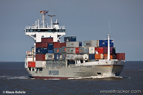
Vessel profile: DUBAI ALLIANCE is a Container Ship with dimensions 121m x 18m.
This page combines live AIS, route history, probable destination signals, nearby traffic, and port activity for practical vessel monitoring.
The current position of vessel DUBAI ALLIANCE is 25.63995 lat / 55.07156 lng. Updated: 2026-05-20 22:47:16 UTCNearest reference points:
- 17 nm NW of Free Port
- Near Sharjah
- Near Free Port
Currently sailing under the flag of Cyprus ![]()
DUBAI ALLIANCE built in 1996 year
Deadweight:
7223 tDetails:
Live Vessel DUBAI ALLIANCE Analytics (details, animations, etc.)
Recent AIS points (UTC):
2026-05-20 19:20:00 UTC · 25.63998, 55.07155 · SOG 0 kn · COG 285°2026-05-20 19:36:27 UTC · 25.63989, 55.07154 · SOG 0.7 kn · COG 271°
2026-05-20 21:43:49 UTC · 25.64162, 55.07326 · SOG 0.2 kn · COG 277°
2026-05-20 22:47:16 UTC · 25.63995, 55.07156 · SOG 0.8 kn · COG 272°