 vesseltracker.com
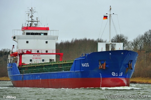
 Naos
Naos
Current Status
Where is the vessel?
Naos is currently in Near Runcorn, based on AIS data received about 1h ago.
Latest AIS update:
Current position: 53.33787° N, 2.75232° W (Near Runcorn)
Average speed (last 7 days): Loading…
Average speed (last 30 days): Loading…
Vessel profile: Naos is a Multi Purpose Carrier with dimensions 90m x 13m.
This page combines live AIS, route history, probable destination signals, nearby traffic, and port activity for practical vessel monitoring.
The current position of vessel Naos is 53.33787 lat / -2.75232 lng. Updated: 2026-04-29 13:48:14 UTCNearest reference points:
- Near ELLESMERE
- Near BIRKENHEAD
- Near LIVERPOOL ANCH
Currently sailing under the flag of Antigua Barbuda ![]()
Naos built in 1996 year
Deadweight:
4258 tDetails:
Live Vessel Naos Analytics (details, animations, etc.)
Recent AIS points (UTC):
2026-04-29 10:38:24 UTC · 53.33787, -2.75232 · SOG 0 kn · COG 222°2026-04-29 12:23:15 UTC · 53.33787, -2.75231 · SOG 0 kn · COG 222°
2026-04-29 13:36:23 UTC · 53.33786, -2.75233 · SOG 0 kn · COG 222°
2026-04-29 13:48:14 UTC · 53.33787, -2.75232 · SOG 0 kn · COG 223°