 BALTIC MERCHANT
Current Status
Where is the vessel?
BALTIC MERCHANT is currently in Near MARIEHAMN, based on AIS data received about 14h ago.
Latest AIS update:
Current position: 60.10609° N, 19.92379° E (Near MARIEHAMN)
Average speed (last 7 days): Loading…
Average speed (last 30 days): Loading…
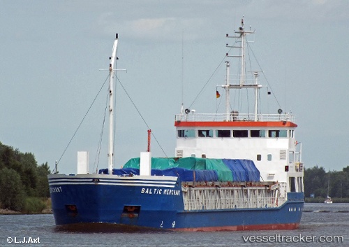
Vessel profile: BALTIC MERCHANT is a General Cargo Ship with dimensions 82m x 12m.
This page combines live AIS, route history, probable destination signals, nearby traffic, and port activity for practical vessel monitoring.
The current position of vessel BALTIC MERCHANT is 60.10609 lat / 19.92379 lng. Updated: 2026-06-13 10:27:22 UTCNearest reference points:
- Near MARIEHAMN
- Near Maarianhamina (Mariehamn)
- Near Finström
Currently sailing under the flag of Latvia ![]()
BALTIC MERCHANT built in 1997 year
Deadweight:
3110 tDetails:
Live Vessel BALTIC MERCHANT Analytics (details, animations, etc.)
Recent AIS points (UTC):
2026-06-13 08:06:22 UTC · 60.10607, 19.92382 · SOG 0 kn · COG 9°2026-06-13 08:27:21 UTC · 60.10605, 19.92384 · SOG 0 kn · COG 9°
2026-06-13 09:39:24 UTC · 60.10604, 19.92384 · SOG 0 kn · COG 9°
2026-06-13 10:27:22 UTC · 60.10609, 19.92379 · SOG 0 kn · COG 10°