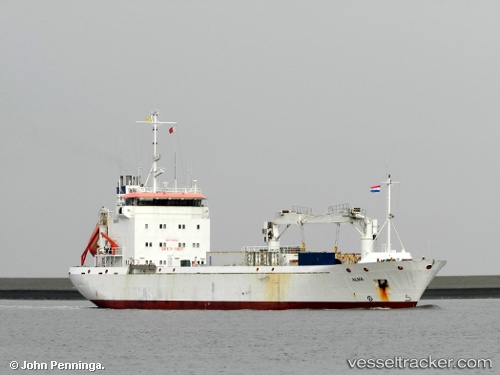
 Alma
Alma
Current Status
Where is the vessel?
Alma is currently in 34 nm S of Neeltje Jans, based on AIS data received about 15h ago.
Latest AIS update:
Current position: 53.08272° N, 3.46771° E (34 nm S of Neeltje Jans)
Average speed (last 7 days): Loading…
Average speed (last 30 days): Loading…
Vessel profile: Alma is a Refrigerated Cargo Ship with dimensions 97m x 16m.
This page combines live AIS, route history, probable destination signals, nearby traffic, and port activity for practical vessel monitoring.
The current position of vessel Alma is 53.08272 lat / 3.46771 lng. Updated: 2026-07-02 17:41:59 UTCNearest reference points:
- 23 nm N of de Ruyter
- Near Neeltje Jans
- 22 nm W of Schoorl
Currently sailing under the flag of Cyprus ![]()
Alma built in 1997 year
Deadweight:
4000 tDetails:
Live Vessel Alma Analytics (details, animations, etc.)
Recent AIS points (UTC):
2026-07-02 14:16:38 UTC · 52.47447, 3.21723 · SOG 10.3 kn · COG 4°2026-07-02 15:57:57 UTC · 52.77697, 3.29338 · SOG 11.3 kn · COG 10°
2026-07-02 16:36:02 UTC · 52.88811, 3.35245 · SOG 11.1 kn · COG 14°
2026-07-02 17:41:59 UTC · 53.08272, 3.46771 · SOG 11.1 kn · COG 21°