 Msc Rochelle
Current Status
Where is the vessel?
Msc Rochelle is currently in 34 nm NE of Corolla, based on AIS data received about 15h ago.
Latest AIS update:
Current position: 36.73455° N, 75.26912° W (34 nm NE of Corolla)
Average speed (last 7 days): Loading…
Average speed (last 30 days): Loading…
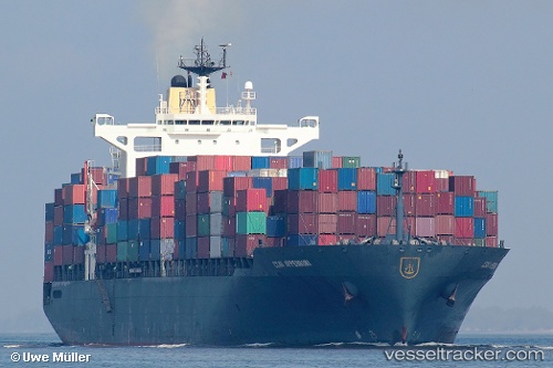
Vessel profile: Msc Rochelle is a Container Ship with dimensions 293m x 32m.
This page combines live AIS, route history, probable destination signals, nearby traffic, and port activity for practical vessel monitoring.
The current position of vessel Msc Rochelle is 36.73455 lat / -75.26912 lng. Updated: 2026-05-21 00:09:39 UTCNearest reference points:
- 26 nm E of Corolla
- 45 nm NE of Nags Head
- 48 nm E of Nags Head
Currently sailing under the flag of Liberia ![]()
Msc Rochelle built in 1997 year
Deadweight:
62200 tDetails:
Live Vessel Msc Rochelle Analytics (details, animations, etc.)
Recent AIS points (UTC):
2026-05-20 19:09:19 UTC · 36.70649, -75.19324 · SOG 1 kn · COG 92°2026-05-20 21:55:00 UTC · 36.72670, -75.20772 · SOG 10.5 kn · COG 250°
2026-05-20 23:10:40 UTC · 36.71365, -75.28120 · SOG 1.3 kn · COG 262°
2026-05-21 00:09:39 UTC · 36.73455, -75.26912 · SOG 1.4 kn · COG 302°