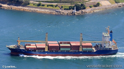
Lila Bhum
Current StatusWhere is the vessel?
Lila Bhum is currently in Near Mandaue City, based on AIS data received about 15h ago.
Latest AIS update:
Current position: 10.30667° N, 123.92333° E (Near Mandaue City)
Average speed (last 7 days): Loading…
Average speed (last 30 days): Loading…
Vessel profile: Lila Bhum is a Container Ship with dimensions 22m x 136m.
This page combines live AIS, route history, probable destination signals, nearby traffic, and port activity for practical vessel monitoring.
The current position of vessel Lila Bhum is 10.30667 lat / 123.92333 lng. Updated: 2026-05-20 01:32:20 UTCNearest reference points:
- Near Mandaue City
- Near Mandaue, Cebu
- Near Danao
Details:
Live Vessel Lila Bhum Analytics (details, animations, etc.)
Recent AIS points (UTC):
2026-05-19 22:22:28 UTC · 10.17178, 123.85531 · SOG 11.8 kn · COG 23°2026-05-20 00:20:58 UTC · 10.30770, 123.92381 · SOG 0.7 kn · COG 221°
2026-05-20 01:25:00 UTC · 10.30827, 123.92337 · SOG 0 kn · COG -1°
2026-05-20 01:32:20 UTC · 10.30667, 123.92333 · SOG 0 kn · COG -1°