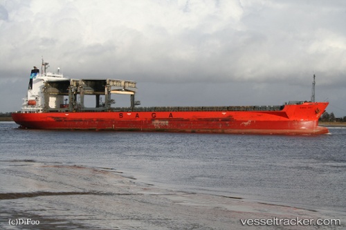
 SAGA SKY
Current Status
Where is the vessel?
SAGA SKY is currently in Near Port Arthur, based on AIS data received about 14h ago.
Latest AIS update:
Current position: 29.85890° N, 93.94073° W (Near Port Arthur)
Average speed (last 7 days): Loading…
Average speed (last 30 days): Loading…
Vessel profile: SAGA SKY is a General Cargo with dimensions m x m.
This page combines live AIS, route history, probable destination signals, nearby traffic, and port activity for practical vessel monitoring.
The current position of vessel SAGA SKY is 29.85890 lat / -93.94073 lng. Updated: 2026-06-17 10:23:23 UTCNearest reference points:
- Near SABINE PASS
- Near Atreco
- Near SUNOCO LOGISTICS
Currently sailing under the flag of Bahamas ![]()
Details:
Live Vessel SAGA SKY Analytics (details, animations, etc.)
Recent AIS points (UTC):
2026-06-17 07:23:28 UTC · 29.85887, -93.94074 · SOG 0 kn · COG -1°2026-06-17 07:51:01 UTC · 29.85890, -93.94070 · SOG 0 kn · COG 41°
2026-06-17 10:02:25 UTC · 29.85889, -93.94075 · SOG 0 kn · COG 41°
2026-06-17 10:23:23 UTC · 29.85890, -93.94073 · SOG 0 kn · COG 41°