 vesseltracker.com
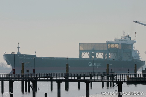
 Plover Arrow
Current Status
Where is the vessel?
Plover Arrow is currently in 158 nm SE of Lenard Harbour, based on AIS data received about 14h ago.
Latest AIS update:
Current position: 53.71833° N, 158.59332° W (158 nm SE of Lenard Harbour)
Average speed (last 7 days): Loading…
Average speed (last 30 days): Loading…
Vessel profile: Plover Arrow is a Multi Purpose Carrier with dimensions 200m x 32m.
This page combines live AIS, route history, probable destination signals, nearby traffic, and port activity for practical vessel monitoring.
The current position of vessel Plover Arrow is 53.71833 lat / -158.59332 lng. Updated: 2026-05-17 22:45:41 UTCCurrently sailing under the flag of Bahamas ![]()
Plover Arrow built in 1997 year
Deadweight:
51421 tDetails:
Live Vessel Plover Arrow Analytics (details, animations, etc.)
Recent AIS points (UTC):
2026-05-17 19:27:36 UTC · 53.63333, -157.84833 · SOG 7 kn · COG -1°2026-05-17 19:41:56 UTC · 53.63804, -157.89703 · SOG 8.1 kn · COG 276°
2026-05-17 21:30:50 UTC · 53.68047, -158.29933 · SOG 8.5 kn · COG 282°
2026-05-17 22:45:41 UTC · 53.71833, -158.59332 · SOG 9 kn · COG -1°