 Brenton Reef
Current Status
Where is the vessel?
Brenton Reef is currently in 207 nm NW of Santa Lucia, based on AIS data received about 14h ago.
Latest AIS update:
Current position: 25.04500° N, 86.73667° W (207 nm NW of Santa Lucia)
Average speed (last 7 days): Loading…
Average speed (last 30 days): Loading…
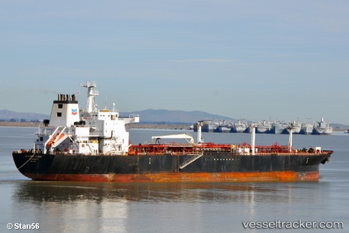
Vessel profile: Brenton Reef is a Chemical Oil Products Tanker with dimensions 189m x 32m.
This page combines live AIS, route history, probable destination signals, nearby traffic, and port activity for practical vessel monitoring.
The current position of vessel Brenton Reef is 25.04500 lat / -86.73667 lng. Updated: 2026-05-21 06:21:07 UTCCurrently sailing under the flag of USA ![]()
Brenton Reef built in 1999 year
Deadweight:
45656 tDetails:
Live Vessel Brenton Reef Analytics (details, animations, etc.)
Recent AIS points (UTC):
2026-05-21 02:15:08 UTC · 25.30333, -87.72500 · SOG 13 kn · COG -1°2026-05-21 03:42:06 UTC · 25.22333, -87.38167 · SOG 13 kn · COG -1°
2026-05-21 04:36:05 UTC · 25.16833, -87.16167 · SOG 13 kn · COG -1°
2026-05-21 06:21:07 UTC · 25.04500, -86.73667 · SOG 14 kn · COG -1°