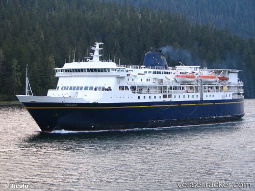
Kennicott
Current StatusWhere is the vessel?
Kennicott is currently in 22 nm NW of Juneau, based on AIS data received about 14h ago.
Latest AIS update:
Current position: 58.54621° N, 134.93536° W (22 nm NW of Juneau)
Average speed (last 7 days): Loading…
Average speed (last 30 days): Loading…
Vessel profile: Kennicott is a Passenger Ro Ro Cargo Ship with dimensions 26m x 116m.
This page combines live AIS, route history, probable destination signals, nearby traffic, and port activity for practical vessel monitoring.
The current position of vessel Kennicott is 58.54621 lat / -134.93536 lng. Updated: 2026-05-19 02:32:42 UTCNearest reference points:
- Near Juneau
- Near Sitka
Details:
Live Vessel Kennicott Analytics (details, animations, etc.)
Recent AIS points (UTC):
2026-05-18 22:02:20 UTC · 58.38167, -134.68333 · SOG 0 kn · COG -1°2026-05-19 00:08:40 UTC · 58.38167, -134.68333 · SOG 0 kn · COG -1°
2026-05-19 01:57:06 UTC · 58.39086, -134.79881 · SOG 17.5 kn · COG 331°
2026-05-19 02:32:42 UTC · 58.54621, -134.93536 · SOG 16.9 kn · COG 333°