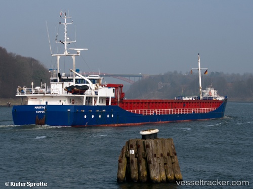
 Marry s
Current Status
Where is the vessel?
Marry s is currently in 37 nm N of Villanueva de Lorenzana, based on AIS data received about 14h ago.
Latest AIS update:
Current position: 44.06500° N, 9.12167° W (37 nm N of Villanueva de Lorenzana)
Average speed (last 7 days): Loading…
Average speed (last 30 days): Loading…
Vessel profile: Marry s is a General Cargo Ship with dimensions 89m x 12m.
This page combines live AIS, route history, probable destination signals, nearby traffic, and port activity for practical vessel monitoring.
The current position of vessel Marry s is 44.06500 lat / -9.12167 lng. Updated: 2026-05-19 19:41:28 UTCNearest reference points:
- 30 nm NW of Meiras-Valdoviño
- 13 nm NE of Villanueva de Lorenzana
- 15 nm NW of CEDEIRA
Currently sailing under the flag of Netherlands ![]()
Marry s built in 1997 year
Deadweight:
3471 tDetails:
Live Vessel Marry s Analytics (details, animations, etc.)
Recent AIS points (UTC):
2026-05-19 14:43:38 UTC · 43.34667, -9.65500 · SOG 10 kn · COG -1°2026-05-19 17:04:11 UTC · 43.69474, -9.39510 · SOG 10.3 kn · COG 24°
2026-05-19 18:05:09 UTC · 43.83833, -9.29167 · SOG 9 kn · COG -1°
2026-05-19 19:41:28 UTC · 44.06500, -9.12167 · SOG 10 kn · COG -1°