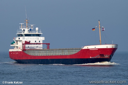
 Nordborg
Current Status
Where is the vessel?
Nordborg is currently in Near Oulu (Uleåborg), based on AIS data received about 15h ago.
Latest AIS update:
Current position: 65.00056° N, 25.40036° E (Near Oulu (Uleåborg))
Average speed (last 7 days): Loading…
Average speed (last 30 days): Loading…
Vessel profile: Nordborg is a Multi Purpose Carrier with dimensions 89m x 13m.
This page combines live AIS, route history, probable destination signals, nearby traffic, and port activity for practical vessel monitoring.
The current position of vessel Nordborg is 65.00056 lat / 25.40036 lng. Updated: 2026-05-19 22:31:24 UTCNearest reference points:
- Near Karlsborg Axelvik
Currently sailing under the flag of Netherlands ![]()
Nordborg built in 1999 year
Deadweight:
3714 tDetails:
Live Vessel Nordborg Analytics (details, animations, etc.)
Recent AIS points (UTC):
2026-05-19 19:25:23 UTC · 65.00056, 25.40028 · SOG 0 kn · COG 108°2026-05-19 20:07:23 UTC · 65.00052, 25.40033 · SOG 0 kn · COG 107°
2026-05-19 21:58:22 UTC · 65.00051, 25.40031 · SOG 0 kn · COG 108°
2026-05-19 22:31:24 UTC · 65.00056, 25.40036 · SOG 0 kn · COG 107°