 TRSAT
TRSAT
Current Status
Where is the vessel?
TRSAT is currently in Near Rijeka, based on AIS data received about 14h ago.
Latest AIS update:
Current position: 45.32876° N, 14.42610° E (Near Rijeka)
Average speed (last 7 days): Loading…
Average speed (last 30 days): Loading…
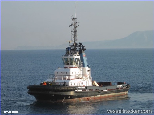
Vessel profile: TRSAT is a Tug with dimensions 32m x 11m.
This page combines live AIS, route history, probable destination signals, nearby traffic, and port activity for practical vessel monitoring.
The current position of vessel TRSAT is 45.32876 lat / 14.42610 lng. Updated: 2026-05-21 04:32:18 UTCNearest reference points:
- Near Rijeka
- Near VALBISKA
- Near Ankaran
Currently sailing under the flag of Croatia ![]()
TRSAT built in 2000 year
Deadweight:
294 tDetails:
Live Vessel TRSAT Analytics (details, animations, etc.)
Recent AIS points (UTC):
2026-05-21 01:23:18 UTC · 45.32876, 14.42606 · SOG 0 kn · COG -1°2026-05-21 01:44:20 UTC · 45.32874, 14.42610 · SOG 0 kn · COG -1°
2026-05-21 04:02:18 UTC · 45.32876, 14.42608 · SOG 0 kn · COG -1°
2026-05-21 04:32:18 UTC · 45.32876, 14.42610 · SOG 0 kn · COG -1°