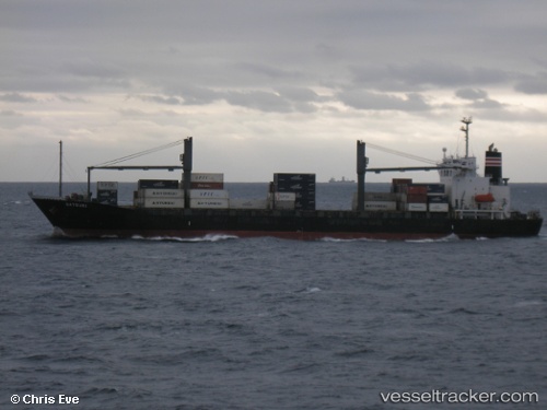
 EASLINE YANTAI
Current Status
Where is the vessel?
EASLINE YANTAI is currently in 17 nm E of Kukdo, based on AIS data received about 15h ago.
Latest AIS update:
Current position: 34.50815° N, 128.76527° E (17 nm E of Kukdo)
Average speed (last 7 days): Loading…
Average speed (last 30 days): Loading…
Vessel profile: EASLINE YANTAI is a Container Ship with dimensions 164m x 26m.
This page combines live AIS, route history, probable destination signals, nearby traffic, and port activity for practical vessel monitoring.
The current position of vessel EASLINE YANTAI is 34.50815 lat / 128.76527 lng. Updated: 2026-06-23 02:38:03 UTCNearest reference points:
- 14 nm E of Kukdo
- 22 nm SE of Kukdo
- 15 nm S of Kukdo
Currently sailing under the flag of Panama ![]()
EASLINE YANTAI built in 1997 year
Deadweight:
17705 tDetails:
Live Vessel EASLINE YANTAI Analytics (details, animations, etc.)
Recent AIS points (UTC):
2026-06-22 22:19:42 UTC · 34.19958, 127.71697 · SOG 13.2 kn · COG 71°2026-06-22 23:44:20 UTC · 34.30320, 128.07632 · SOG 13.3 kn · COG 69°
2026-06-23 01:39:59 UTC · 34.43643, 128.54591 · SOG 12.2 kn · COG 71°
2026-06-23 02:38:03 UTC · 34.50815, 128.76527 · SOG 11.9 kn · COG 60°