 Da Fu
Da Fu
Current Status
Where is the vessel?
Da Fu is currently in 11 nm SW of Lushun New Pt, based on AIS data received about 14h ago.
Latest AIS update:
Current position: 38.54788° N, 121.03699° E (11 nm SW of Lushun New Pt)
Average speed (last 7 days): Loading…
Average speed (last 30 days): Loading…
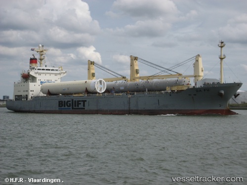
Vessel profile: Da Fu is a General Cargo Ship with dimensions 153m x 23m.
This page combines live AIS, route history, probable destination signals, nearby traffic, and port activity for practical vessel monitoring.
The current position of vessel Da Fu is 38.54788 lat / 121.03699 lng. Updated: 2026-05-22 16:45:04 UTCNearest reference points:
- 13 nm S of Lushun New Pt
- Near Lushun New Pt
- 18 nm W of Lushun New Pt
Currently sailing under the flag of Panama ![]()
Da Fu built in 1998 year
Deadweight:
16957 tDetails:
Live Vessel Da Fu Analytics (details, animations, etc.)
Recent AIS points (UTC):
2026-05-22 13:52:35 UTC · 38.22190, 121.70507 · SOG 13 kn · COG 304°2026-05-22 14:13:13 UTC · 38.26866, 121.62710 · SOG 13.2 kn · COG 305°
2026-05-22 16:18:43 UTC · 38.49850, 121.14018 · SOG 13 kn · COG 301°
2026-05-22 16:45:04 UTC · 38.54788, 121.03699 · SOG 12.8 kn · COG 302°