 vesseltracker.com
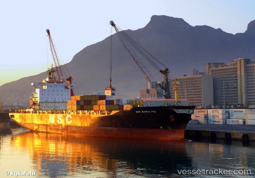
 Msc Maria Pia
Current Status
Where is the vessel?
Msc Maria Pia is currently in Near Turnberry, based on AIS data received less than 1h ago.
Latest AIS update:
Current position: 55.42001° N, 4.98472° W (Near Turnberry)
Average speed (last 7 days): Loading…
Average speed (last 30 days): Loading…
Vessel profile: Msc Maria Pia is a Container Ship with dimensions 196m x 33m.
This page combines live AIS, route history, probable destination signals, nearby traffic, and port activity for practical vessel monitoring.
The current position of vessel Msc Maria Pia is 55.42001 lat / -4.98472 lng. Updated: 2026-05-14 11:34:32 UTCNearest reference points:
- Near Lamlash
- Near Turnberry
- Near Girvan
Currently sailing under the flag of Panama ![]()
Msc Maria Pia built in 1997 year
Deadweight:
40100 tDetails:
Live Vessel Msc Maria Pia Analytics (details, animations, etc.)
Recent AIS points (UTC):
2026-05-14 07:23:22 UTC · 55.42223, -4.88556 · SOG 1.3 kn · COG 75°2026-05-14 09:43:51 UTC · 55.46577, -4.98337 · SOG 1.1 kn · COG 263°
2026-05-14 10:38:41 UTC · 55.44508, -4.98466 · SOG 1.2 kn · COG 263°
2026-05-14 11:34:32 UTC · 55.42001, -4.98472 · SOG 1.5 kn · COG 258°