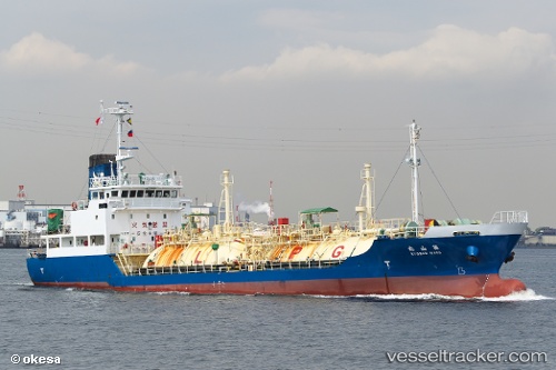
Pilatus 54
Current StatusWhere is the vessel?
Pilatus 54 is currently in Near Map Ta Phut, based on AIS data received about 14h ago.
Latest AIS update:
Current position: 12.58901° N, 101.13479° E (Near Map Ta Phut)
Average speed (last 7 days): Loading…
Average speed (last 30 days): Loading…
Vessel profile: Pilatus 54 is a Lpg Tanker with dimensions 11m x 65m.
This page combines live AIS, route history, probable destination signals, nearby traffic, and port activity for practical vessel monitoring.
The current position of vessel Pilatus 54 is 12.58901 lat / 101.13479 lng. Updated: 2026-05-20 09:47:58 UTCNearest reference points:
- 11 nm S of Map Ta Phut
- Near SATTAHIP
- Near Tips Container Terminal
Details:
Live Vessel Pilatus 54 Analytics (details, animations, etc.)
Recent AIS points (UTC):
2026-05-20 06:18:27 UTC · 12.67277, 100.72827 · SOG 11.3 kn · COG 118°2026-05-20 07:33:06 UTC · 12.55668, 100.91656 · SOG 9.8 kn · COG 111°
2026-05-20 07:52:48 UTC · 12.54062, 100.96432 · SOG 9.4 kn · COG 78°
2026-05-20 09:47:58 UTC · 12.58901, 101.13479 · SOG 0 kn · COG 157°