 Laura S
Current Status
Where is the vessel?
Laura S is currently in Near Praia Da Vitoria, based on AIS data received about 14h ago.
Latest AIS update:
Current position: 38.71157° N, 27.05243° W (Near Praia Da Vitoria)
Average speed (last 7 days): Loading…
Average speed (last 30 days): Loading…
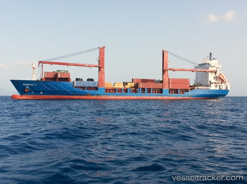
Vessel profile: Laura S is a Container Ship with dimensions 120m x 21m.
This page combines live AIS, route history, probable destination signals, nearby traffic, and port activity for practical vessel monitoring.
The current position of vessel Laura S is 38.71157 lat / -27.05243 lng. Updated: 2026-05-20 07:23:36 UTCNearest reference points:
- Near Praia Da Vitoria
- 81 nm SW of Matillas
Currently sailing under the flag of Portugal ![]()
Laura S built in 1998 year
Deadweight:
6770 tDetails:
Live Vessel Laura S Analytics (details, animations, etc.)
Recent AIS points (UTC):
2026-05-20 03:52:35 UTC · 38.71167, -27.05167 · SOG 0 kn · COG -1°2026-05-20 04:22:39 UTC · 38.71167, -27.05167 · SOG 0 kn · COG -1°
2026-05-20 05:46:53 UTC · 38.71167, -27.05167 · SOG 0 kn · COG -1°
2026-05-20 07:23:36 UTC · 38.71157, -27.05243 · SOG 0 kn · COG 13°