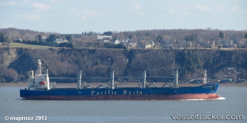
Harmony Ocean
Current StatusWhere is the vessel?
Harmony Ocean is currently in 113 nm N of Palau, based on AIS data received about 15h ago.
Latest AIS update:
Current position: 11.42953° N, 137.92163° E (113 nm N of Palau)
Average speed (last 7 days): Loading…
Average speed (last 30 days): Loading…
Vessel profile: Harmony Ocean is a Bulk Carrier with dimensions 26m x 177m.
This page combines live AIS, route history, probable destination signals, nearby traffic, and port activity for practical vessel monitoring.
The current position of vessel Harmony Ocean is 11.42953 lat / 137.92163 lng. Updated: 2026-07-11 15:14:09 UTCNearest reference points:
- 150 nm N of Palau
- 207 nm N of Palau
- 77 nm NW of Palau
Details:
Live Vessel Harmony Ocean Analytics (details, animations, etc.)
Recent AIS points (UTC):
2026-07-11 11:48:14 UTC · 11.05701, 138.18100 · SOG 8.1 kn · COG 327°2026-07-11 13:11:43 UTC · 11.20852, 138.07410 · SOG 7.9 kn · COG 322°
2026-07-11 13:47:41 UTC · 11.27555, 138.02907 · SOG 7.7 kn · COG 328°
2026-07-11 15:14:09 UTC · 11.42953, 137.92163 · SOG 7.6 kn · COG 320°