 BALTIC LADY
Current Status
Where is the vessel?
BALTIC LADY is currently in 307 nm SE of Totegegie, based on AIS data received about 15h ago.
Latest AIS update:
Current position: 26.90757° S, 131.13551° W (307 nm SE of Totegegie)
Average speed (last 7 days): Loading…
Average speed (last 30 days): Loading…
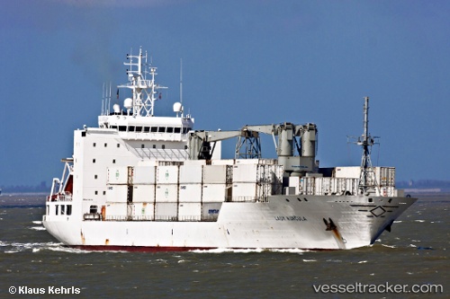
Vessel profile: BALTIC LADY is a Refrigerated Cargo Ship with dimensions 23m x 155m.
This page combines live AIS, route history, probable destination signals, nearby traffic, and port activity for practical vessel monitoring.
The current position of vessel BALTIC LADY is -26.90757 lat / -131.13551 lng. Updated: 2026-05-20 07:59:14 UTCNearest reference points:
- 351 nm SE of Totegegie
- Open sea, approx. 404 nm off the nearest listed port
- Open sea, approx. 409 nm off the nearest listed port
Currently sailing under the flag of Bahamas ![]()
BALTIC LADY built in 2000 year
Deadweight:
12913 tDetails:
Live Vessel BALTIC LADY Analytics (details, animations, etc.)
Recent AIS points (UTC):
2026-05-20 04:16:10 UTC · -26.47138, -130.11440 · SOG 15.9 kn · COG 244°2026-05-20 06:34:07 UTC · -26.73523, -130.74644 · SOG 16.4 kn · COG 243°
2026-05-20 07:39:30 UTC · -26.86765, -131.04507 · SOG 16.5 kn · COG 242°
2026-05-20 07:59:14 UTC · -26.90757, -131.13551 · SOG 16.8 kn · COG 242°