 vesseltracker.com
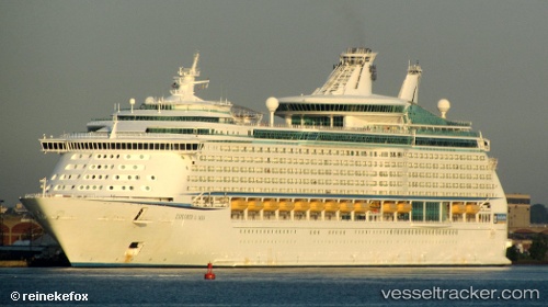
 Explorer Of The Seas
Current Status
Where is the vessel?
Explorer Of The Seas is currently in Near KOTOR, based on AIS data received about 1h ago.
Latest AIS update:
Current position: 42.46046° N, 18.75533° E (Near KOTOR)
Average speed (last 7 days): Loading…
Average speed (last 30 days): Loading…
Vessel profile: Explorer Of The Seas is a Cruise Ship with dimensions 311m x 39m.
This page combines live AIS, route history, probable destination signals, nearby traffic, and port activity for practical vessel monitoring.
The current position of vessel Explorer Of The Seas is 42.46046 lat / 18.75533 lng. Updated: 2026-05-14 13:17:48 UTCNearest reference points:
- Near TIVAT
- Near Zelenika
- Near Zelinika
Currently sailing under the flag of Bahamas ![]()
Explorer Of The Seas built in 2000 year
Deadweight:
10937 tDetails:
Live Vessel Explorer Of The Seas Analytics (details, animations, etc.)
Recent AIS points (UTC):
2026-05-14 10:38:51 UTC · 42.46048, 18.75507 · SOG 0.5 kn · COG 222°2026-05-14 11:02:49 UTC · 42.46061, 18.75522 · SOG 0 kn · COG 168°
2026-05-14 13:17:48 UTC · 42.46046, 18.75533 · SOG 0 kn · COG 170°
2026-05-14 13:17:48 UTC · 42.46046, 18.75533 · SOG 0 kn · COG 170°