 T MED
T MED
Current Status
Where is the vessel?
T MED is currently in Near Maltepe, based on AIS data received about 14h ago.
Latest AIS update:
Current position: 40.86838° N, 29.17083° E (Near Maltepe)
Average speed (last 7 days): Loading…
Average speed (last 30 days): Loading…
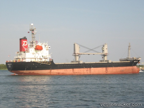
Vessel profile: T MED is a General Cargo Ship with dimensions 105m x 16m.
This page combines live AIS, route history, probable destination signals, nearby traffic, and port activity for practical vessel monitoring.
The current position of vessel T MED is 40.86838 lat / 29.17083 lng. Updated: 2026-05-21 02:02:52 UTCNearest reference points:
- Near PENDIK
- Near TUZLA
- Near BOSTANCI
Currently sailing under the flag of Panama ![]()
T MED built in 1997 year
Deadweight:
6830 tDetails:
Live Vessel T MED Analytics (details, animations, etc.)
Recent AIS points (UTC):
2026-05-20 22:14:48 UTC · 40.86897, 29.17108 · SOG 0.2 kn · COG 253°2026-05-21 00:20:50 UTC · 40.86850, 29.17096 · SOG 0 kn · COG 285°
2026-05-21 00:59:49 UTC · 40.86839, 29.17095 · SOG 0 kn · COG 290°
2026-05-21 02:02:52 UTC · 40.86838, 29.17083 · SOG 0 kn · COG 295°